Mt. Hochfeiler – the best hiking and mountaineering itineraries

Conquer Mt. Hochfeiler and other impressive three-thousanders, enjoy a leisurely walk in the valley or set off on a bike tour to the local Alpine huts, choosing from a variety of trails at various altitudes. Here are some of our insider tips for you.
A great view from the Pfitscherjoch-Haus shelter

The hike from Pfitscherjoch-Haus to the Rotbachlspitze peak takes two hours to complete. At the top, you will see the boundary stone marking the border between Italy and Austria.

The climb along partially exposed footpaths leading all the way up to the Hochfeiler summit is rather challenging but equally rewarding. At an altitude of 3,510 metres, it is the highest peak in the Zillertal Alps.
If you are looking for a family-friendly walking trail through meadows and woodland, we recommend heading to the Moassl waterfall, a natural place of power at the end of the Pfitschtal valley.
The high alpine mountain tour to the Rotes Beil summit (altitude 2,950 m) starts at the hamlet of Kinzen. It leads initially through the woods and then over a rocky ridge.
The steep, usually solitary climb to the Grabspitze peak (altitude 3,095 m) leads through a wild, unspoilt mountainscape.

The summit tour to the Kraxentrager peak (altitude 2,999 m) is highly scenic, with the option of stopping by at the Europahütte hut.

If you’re looking for rugged rockfaces to challenge, climb the Ölberg via ferrata in Afens (ten kilometres from Knappenhof).

Enjoy your holiday to the fullest – with the activeCARD Sterzing

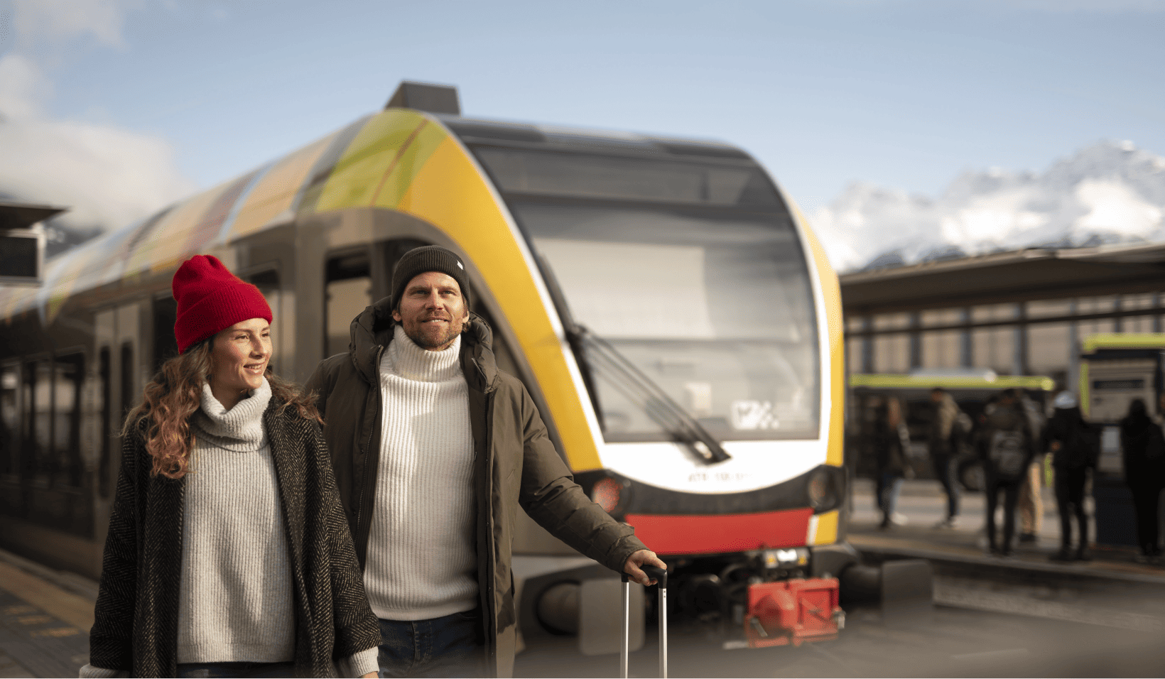
As our guest, you will receive a complimentary digital activeCARD Sterzing – a tourist card you can use to travel for free on public transport across South Tyrol (buses, regional trains and some lift facilities) and enjoy a range of advantages, including a 20% discount on the Rosskopf, Ladurns and Ratschings lifts, free access to the guided activities of the Tourist Office’s weekly programme and more.